Detail Itinerary
|
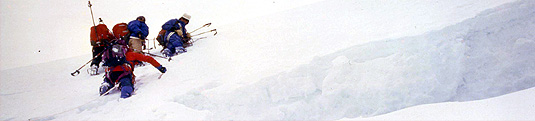
MILAM
GLACIER |
|
Review:
|
Milam is the last major settlement
before Tibet, there are only three pass for traders For
traders and
shepherds to reach Tibet, there are three passes only and they
are Unta Dhura, Jainta Dhura
and Kangri Bingri La. This was a trade centre. Though having close association with Tibetans, the villagers of
Milam do not like to be called Tibetan or Bhotia. They are
Rajputs, their ancestors have migrated from Rajasthan in
the 12th century. This trek is a beautiful with panoramic views
of towering peaks and natural beauty.
|
Ref: |
GNH. |
Grade: |
Moderate |
| Duration: |
17 Days. (Actual
Trek 09 Days, Mansuyari - Milam Mansuyari) |
Season: |
May - Jun & Sep - Oct. |
Itinerary: |
Delhi -
Ranikhet - Pithoragarh -
Mansuyari - Trek - Milam - Mansuyari
- Pithoragarh - Ranikhet -
Delhi |
DAY 01.
ARRIVE DELHI Morning
arrive Delhi and transfer to hotel. Afternoon combined guided tour of Old
and New Delhi includes Jammia Masjid Mosque, Cycle rickshaw ride
through Chandni chowk, Red Fort, drive through India Gate and
Parliament house. And finally explore Qutab Minar and Humayuns Tomb.
DAY
02. DELHI RANIKHET
Drive 363 Km
After
an early breakfast we depart for a long drive to Ranikhet, we travel
through the crowded roads of Uttar Pradesh, later we gradually ascend
and enter into Himalayan region of Kumaon. En route we stop for lunch,
soft drinks, tea, coffee and photography. Late afternoon arrive and
check in at hotel for overnight. Ranikhet,
which means Queens Field, said to be named after the wife of
Raja Sudhar Deve of the 12th century. it is situated along
a ridge at an altitude of 1830 Mt., covered by forest of Oak and Pine,
and commands excellent view of snow covered peaks on northern side.
DAY 03.
RANIKHET PITHORAGARH
Drive 158 Km A day long drive
through lofty mountain road to Pithoragarh, a Pine forest. Arrive and
check in at tourist bungalow / guest house for overnight. Pithoragarh
nestles in a small valley situated at an altitude of 1645 Mt. it was
an important land mark of Kumaons Chand Rajas, called Sor Valley.
Most of the government offices are at a distance of 7 Km in the hill
fort and this is the district headquarter. The population is about
22,000 and it falls on an important pilgrimage route to Mount Kailash
and Mansarovar Lake.
DAY 04.
PITHORAGARH MUNSAYARI
Drive 128 Km Morning
drive through lofty mountain roads to Munsayari, a picturesque town
and base for our trek to Milam glacier. Arrive and check in at guest
house / camp for overnight.
DAY 05 to 13.
TREK After
breakfast we distribute our load among porters / pack animals and
Commence our trek, we head north east towards Johar valley from Darkot
village (1800 Mt.), then a steady descend towards Gori Ganga. Then the
trail follows the right side of the river and pass through number of
small villages and some of the houses constructed here are of bamboo
to provide some relief from the humid temperature of summer which goes
up to 30 degree Cs before monsoon seasons and w camp for overnight at Lelam
(1850 Mt.). For our second stage of trek we again follow the Gori
Ganga or climb 1000 Mt. ridge high above Lelam and then descend down
to Gori Ganga (this is an alternative) to re join the main trail. The
trail winds up the open hill side and commands panoramic views of Munsayari.
The last 310 Mt. stretch to Lelam ridge (2850 Mt.) goes up
to narrow gully, here we need to be cautious of boulders which come
down due to flocks passing above. The Lelam ridge provides panoramic
view of Panchuli range towards east and on the north side the
steep George of the Gori Ganga and its tributary Rilamgarh. Then the
trek descends through rhododendron and conifers first thereafter by
the forest of bamboo and chestnut to a small meadow over looking the
Gori Ganga River. From the river side ascend a George and continue for
a few kilometers up to the meadow of Bodgwar (2690 Mt.), pass
some military huts until we reach a grassy ridge near the main river
for overnight camp. On our next stage still follow Gori Ganga through
some narrow George, then cross some snow bridges, thereafter the
George widens around a small meadow. Further the trail passes through
some meadows until we reach small hamlet of Raikot (3100 Mt.).
Soon after that when we turn towards north we get the first glimpses
of high mountain peaks beyond Milam and we camp at Martoli
(3430 Mt.), which is the grassy plateau high above the confluence of
Gori Ganga and the Lwanl Gad, the river flowing from Nanda devi east.
This was a large village while there was tremendous trade with Tibet
until 1962, when the border was closed. Our next and the final stage
is comparatively short and commands both spectacular views of the
upper Himalayas including the main peak of Nanda Devi. From Martoli,
we descend steeply to the bridge over the Lwanl Gad, then trek on the
right side of the valley till Burphu (3350 Mt.), here we cross
over Gori Ganga through a wooden bridge. We continue our trek and pass
by some settlement of Beiju from where the Milam is just a few
Kilometers away. The Milam is beyond the confluence of Gori Ganga
which flows from Milam glacier and the Goenka gad river which flows
from the north east. Milam (3450 Mt.) is the last major settlement
before Tibet, which is just few stage away passing through Unta Dhura,
the Jainta Dhura and the Kangri Bingri La. The villagers here trace
their route to the Rajput tribes of Rajasthan who migrated to this
place in the 12th century. After exploring the village and
enjoying the views, camp for overnight. We move back to Munsayari for
our last camp.
DAY 14.
MUNSYARI PITHORAGARH
Drive 150 Km After
breakfast we bid good bye to our porters and pack animal crews, depart
for a day long drive to Pithoragarh. Arrive and check in at tourist
bungalow / guest house for overnight.
DAY 15.
PITHORAGARH RANIKHET
Drive 158 Km
After
leisurely breakfast we drive back to Ranikhet. Arrive and check in at
tourist bungalow / hotel for overnight stay.
DAY 16.
RANIKHET DELHI
Drive 356 Km
Today
we leave early in the morning and drive down to plains of Uttar
Pradesh and continue on to Delhi. Arrive and check in at hotel for
overnight stay.
DAY 17.
DEPARTURE Transfer
to airport for homeward destination.
Some of the other treks available
are :
 DEBAI -
TAPOVAN YUMNOTRY
DODITAL SOURCE OF
GANGES
DEBAI -
TAPOVAN YUMNOTRY
DODITAL SOURCE OF
GANGES
Itineraries can be forwarded on request.